UN
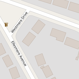
34 Westmere Drive
£ 362,500
Description
We don't have a Description for this property.
- Bedrooms
- 2
- Bathrooms
- 0


Leaflet © OpenStreetMap contributors
The heatmap indicates the level of crime in the area. The color of the heatmap indicates the crime severity and recency.
Metrics Year-on-Year
- Average area value
- 666,863.00 £Decreased by 49.22 %
- Average area rental value
- 2,159.00 £/moDecreased by 16.61 %
- Est rental Yield
- 3.89 %Increased by 64.14 %
- Crime Rate
- 8.00 %Unchanged by 0.00 %
from 1,313,349.00 £
from 2,589.00 £/mo
from 2.37 %
from 8.00 %
Nearby Schools
| Name | Type | Ofsted | Distance |
|---|---|---|---|
| Northway School | Community Special School | Outstanding | 0.26 KM |
| Fairway Primary School And Children'S Centre | Community School | Good | 0.26 KM |
| Fairway Primary School And Children'S Centre | Children's Centre | 0.30 KM | |
| Courtland School | Community School | Outstanding | 0.61 KM |
| Mathilda Marks-Kennedy Jewish Primary School | Voluntary Aided School | Outstanding | 1.09 KM |
Images
Nearby Streets
| Name | Average Price | Average Sqft | Distance |
|---|---|---|---|
| Manor Drive | £ 925,000 | 0 | 0.00 KM |
| Kenilworth Road | £ 595,000 | 0 | 0.00 KM |
| Marsh Lane | £ 2,044,158 | 0 | 0.00 KM |
| Limes Avenue | £ 999,000 | 0 | 0.00 KM |
| Hurstmere Court | £ 900,000 | 0 | 0.00 KM |
Nearby Transport
| Name | NLC | TLC | Distance |
|---|---|---|---|
| Mill Hill Broadway | 1527 | MIL | 1.62 KM |
| Elstree And Borehamwood | 1542 | ELS | 3.99 KM |
| Hendon | 1522 | HEN | 5.43 KM |
| Kenton | 1399 | KNT | 8.14 KM |
| South Kenton | 1453 | SOK | 8.30 KM |
Nearby Listings
| Address | Price | Type | Score | Distance |
|---|---|---|---|---|
| Westmere Drive, Mill Hill | £ 365,000 | BUY | 6 / 10 | 0.00 KM |
| Laurel Gardens, Mill Hill, NW7 | £ 875,000 | BUY | 6 / 10 | 0.06 KM |
| Westmere Drive, London | £ 385,000 | BUY | Unknown | 0.07 KM |
| Westmere Drive, London | £ 350,000 | BUY | Unknown | 0.07 KM |
| Westmere Drive, London | £ 350,000 | BUY | 5 / 10 | 0.07 KM |
Nearby Properties
| Address | Price | Distance |
|---|---|---|
| 22 Westmere Drive | £ 250,000 | 0.00 KM |
| 38 Westmere Drive | £ 376,000 | 0.00 KM |
| 42 Westmere Drive | £ 382,000 | 0.00 KM |
| 50 Westmere Drive | £ 278,000 | 0.00 KM |
| 32 Westmere Drive | £ 145,000 | 0.00 KM |